![Tropical Cyclone Warning Number 59 issued at 7:14am Thursday 17 December 2020 [Image: fiji.met.gov]](https://www.fijivillage.com/news_images/21317528895fda6ab7c3047f86bd15.jpg)
A Tropical Cyclone Warning remains in force for Viti Levu, Vanua Levu, Taveuni, Yasawa, Mamanuca Group and nearby smaller islands, Matuku, Moala, Totoya and the Lomaiviti Group.
A Tropical Cyclone Alert remains in force for the rest of Fiji.
A Storm Surge and Damaging Heavy Swell Warning is in force for the coastal waters of Rotuma, Yasawa and Mamanuca Group, Viti Levu, Vanua Levu, Taveuni, Lau and the Lomaiviti Group.
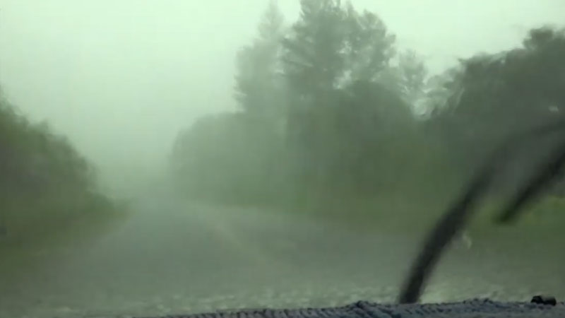
A Heavy Rain Warning remains in force for the whole of Fiji.
A Flash Flood Alert is in force for all low lying areas of Fiji.
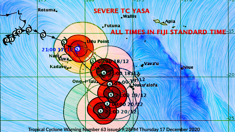
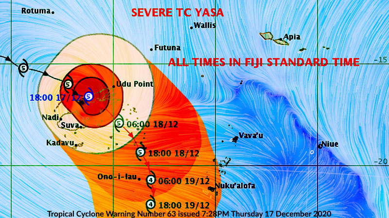
Category 5 Severe Tropical Cyclone Yasa is located about 300 kilometres North North West of Nadi and about 320 kilometres South South West of Rotuma.
The system is currently moving eastwards at about 16 kilometres per hour.
On this projected track, the centre of Cyclone Yasa is expected to be located about 170 kilometres North of Nadi at 3pm today.
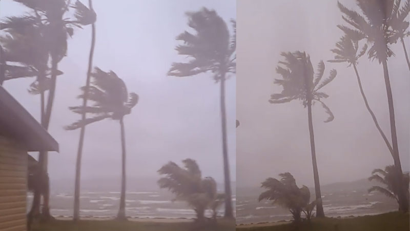
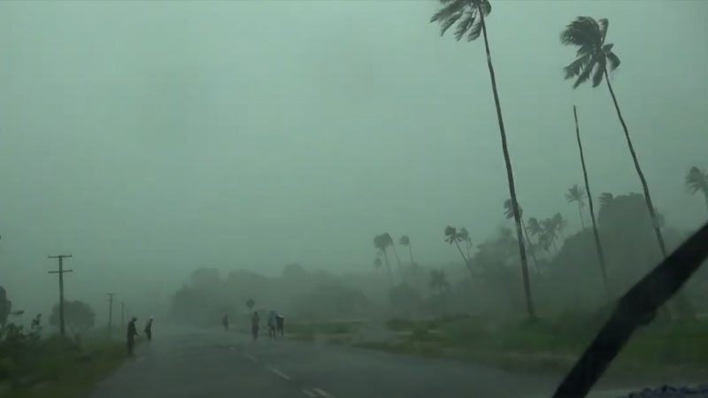
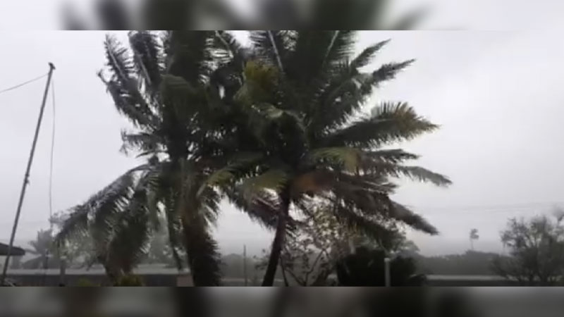
Destructive winds are likely to begin several hours before the cyclone centre passes overhead or nearby. Please be prepared for winds to pick up from damaging to destructive and very destructive.
Winds can increase to damaging gale force winds with average speeds of upto 75 kilometres per hour from later today.

There is a risk of flooding of coastal areas from storm surges and damaging heavy swells during high tide.
Strong winds and heavy rain is expected to start easing over Rotuma from Saturday.
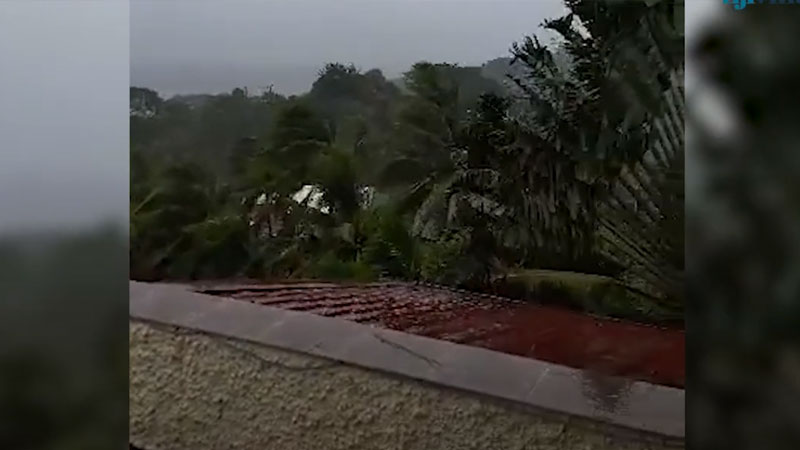
For Viti Levu, Vanua Levu, Yasawa and Mamanuca Group and nearby smaller islands - strong winds with momentary gusts of upto 65 kilometres per hour is expected today.
This is expected to further increase to destructive storm force and very destructive hurricane force winds upto 185 kilometres per hour with momentary gusts upto 260 kilometres per hour by 3pm today.
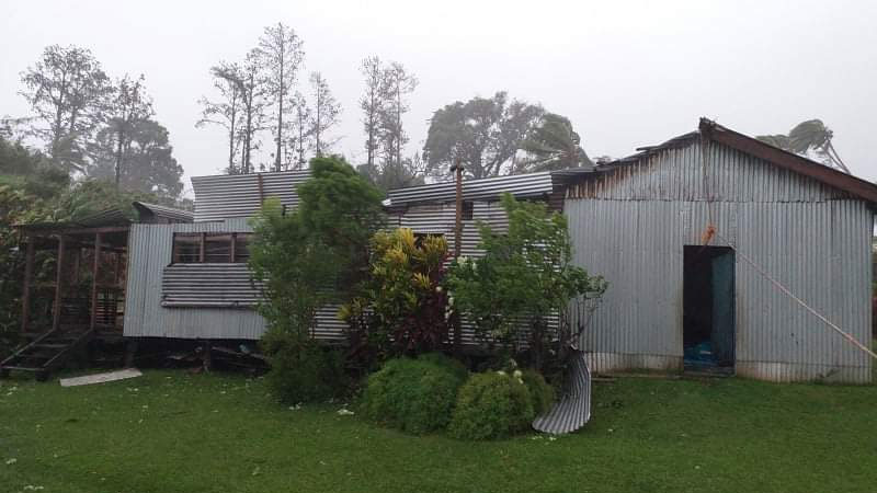
The Weather Office says destructive storm force and very destructive hurricane force winds can be extremely dangerous with widespread destruction.
It can cause widespread damage to property and infrastructure, severe disruption to electrical power distribution and communication services.
It can uproot big trees and cause total damage to crops and vegetation.
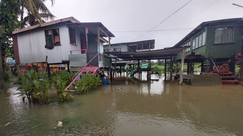
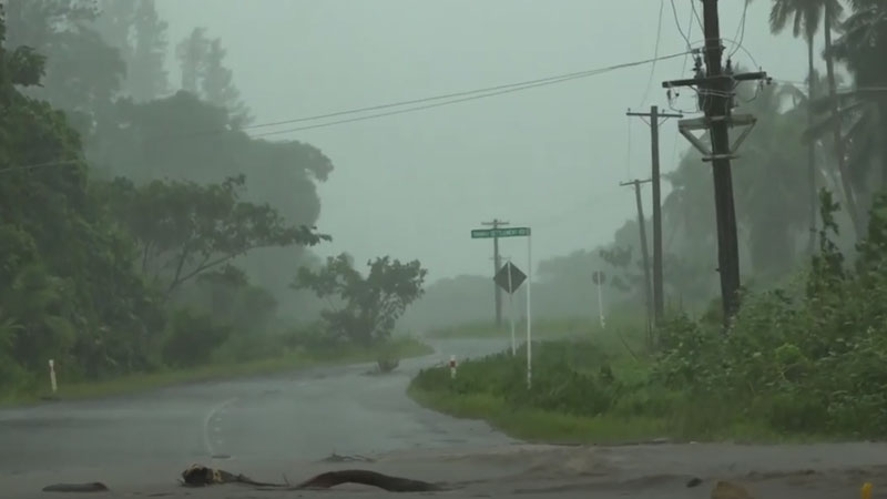
Heavy rain can cause flash flooding of low lying areas and flood prone areas from later today.
High waves of more than 5 to 7 metres can be expected over these areas from today.
Significant wave height of 14 metres or more and damaging heavy swells is expected when the eye of the cyclone moves closer. There is a risk of sea flooding of low-lying coastal areas especially during high tide from storm surges and damaging heavy swells today and tomorrow.
Tomorrow, the whole of Fiji is expected to experience damaging winds or stronger, widespread heavy rain that can cause landslides, severe flooding and bursting of river banks, storm surges, damaging heavy swells and high waves that can cause sea flooding in coastal areas.
Have your supplies ready, have some standby non-perishable food items and water, ensure you have a transistor radio and batteries to follow the weather reports on Legend FM and ensure you have emergency lights and torches.
You can also contact us on 3314766, Vodafone number 9923352 or our Digicel number 7734766 for any queries on evacuation centres or assistance for emergency personnel.
Stay with us for developments.