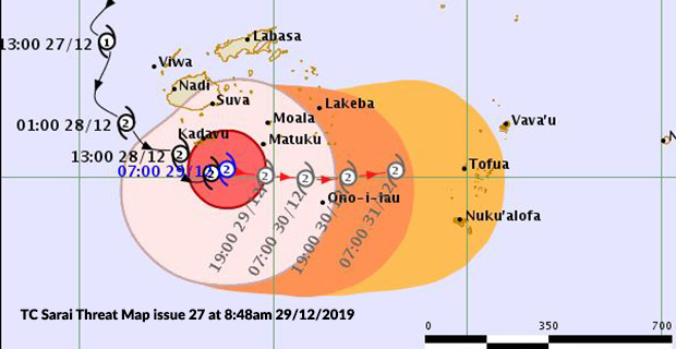
Tropical Cyclone Sarai is continuing to move closer to the Lau group while people in Kadavu are still experiencing some strong winds.
People in Kadavu as well as Matuku, Moala and Totoya in Lau are being urged to continue to remain on high alert as they should expect damaging storm force winds today while those of you in Viti Levu, Vanua Levu, Taveuni, Vatulele, Beqa, Mamanuca Group and Lomaiviti should expect gale-force winds.
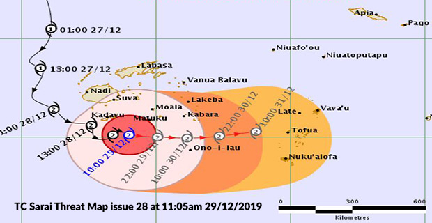
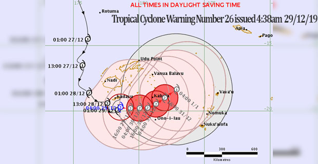
TC Sarai was located at about 130km South East of Kadavu or about 120 kilometres South West of Matuku in Lau at 10am today.
The Nadi Weather Office says close to its centre, TC Sarai is expected to have average winds of up to 110 kilometres per hour with momentary gusts of 150 kilometres per hour.
TC Sarai is moving East South East at about 10 kilometres per hour.
FORECAST FOR KADAVU, MATUKU, MOALA AND TOTOYA
Expect destructive storm force winds with average speeds of 110km/hr with momentary gusts to 150km/hr.
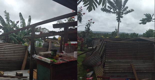
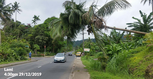
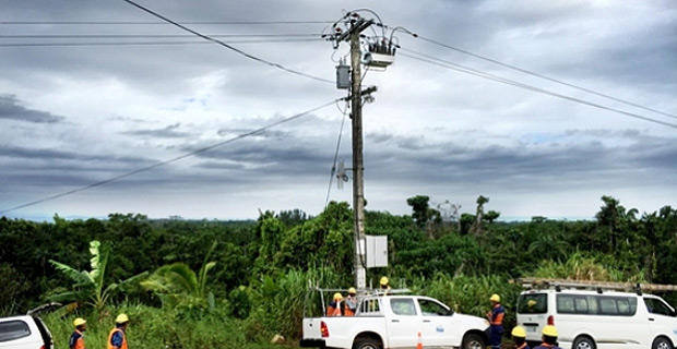
These storm force winds can cause damage to structures and many shallow rooted trees could be snapped or uprooted and block numerous roads. Unplanned power outages are also expected.
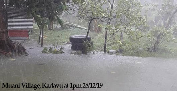
Also expect very high seas and periods of heavy rain.
Coastal sea flooding to be expected during high tides if the cyclone centre passes nearby.
FORECAST FOR VITI LEVU, VANUA LEVU, TAVEUNI, MAMANUCA GROUP, BEQA AND VATULELE, LOMAIVITI GROUP AND REST OF THE LAU GROUP
Expect damaging gale force winds with average speeds of 80km/hr with momentary gusts to 100km/hr. High seas.
Expect high seas and occasional rain which will be heavy at times.
Localised heavy rain may lead to flash flooding of low lying areas.
Sea flooding to be expected during high tides if the cyclone centre passes by..
ANTICIPATED TRACK
The centre of Tropical Cyclone Sarai should be located about 80km south-southwest of Matuku or 190km west-southwest of Kabara at 6pm today and about 80km south-southeast of Matuku or 130km southwest of Kabara at 6am tomorrow.