![Tropical Cyclone Warning Number 16 issued 8:39am FJT Friday 27 December 2019 [Photo:Fiji Meteorological Service]](https://www.fijivillage.com/news_images/3236636155e051c48c981400ca9e19.jpg)
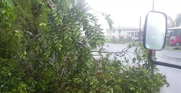
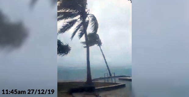
People are being urged to prepare now as Tropical Depression 03F intensified into a Category 1 Tropical Cyclone overnight and there is now a strong wind warning and heavy rain warning in place for the Fiji group.
Please note rain is anticipated to become frequent and heavy today and localised heavy rain may lead to flash flooding of low lying areas.
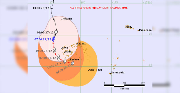
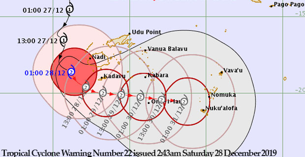
Tropical Cyclone Warning Number 16 issued 8:51am Friday 27 December 2019
Close to its centre, Cyclone Sarai is expected to have average winds of up to 65 kilometres per hour with momentary gusts of 90 kilometres per hour.
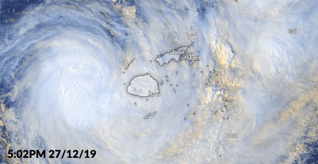
Cyclone Sarai is moving South at 35 kilometres per hour.
The Nadi Weather Office says Cyclone Sarai is expected to move south and the centre should be about 260 kilometres west of Yasawa-i-Rara or about 180 kilometres West North West of Nadi by 3pm today.
A Category 1 Cyclone can cause damage to crops and trees and blow over unsecured objects.
From tomorrow, those living in Viti Levu, Vanua Levu, Taveuni, Yasawa and Mamanuca group and nearby smaller islands should expect an increase in damaging gale force winds with an average speed of 65 kilometres per hour with momentary gusts of 90 kilometres per hour.
People can expect damaging gale force winds several hours before the centre of the system passes overhead or nearby.
Please also note that coastal sea flooding should be expected during high tide if the centre of the system passes nearby.
The Nadi Weather Office says based on its projected track, Tropical Cyclone Sarai is expected to intensify into a Category 2 system and pass just southwest of Nadi at 1 o’clock tomorrow morning.
People can send us videos and photos on our Facebook page if anyone is suffering from flash flooding.